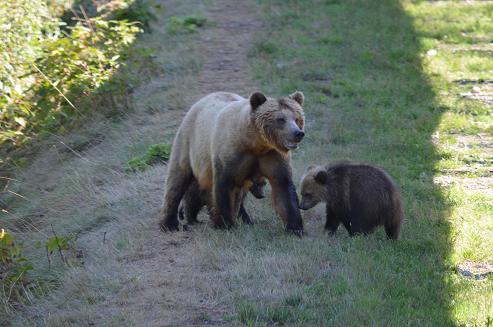
This photo shows a mother grizzly and her cubs. She has three just not all in this photo, like kids some are a little wayward. The family is walking the causeway between the two viewing stands we use on the Glendale River after August 24th. To get a sense of the stand’s location if you go to “Pages” on the lower left side of this page and click on “Google Map of Itinerary” you will view a map showing Vancouver Island and four blue “Icons”. If you zoom in on the icon to the right until the written name of Tom Brown Lake is large and easy to read. Click on the green square in the lower left corner and this becomes a Google Earth Map. Continue to zoom in slowly keeping the focus on the end of Tom Brown Lake closest to the blue icon. The zigzag of greenery is the trees surrounding the man made spawning channel. The “dirt coloured” area at the left corner of the spawning channel is the causeway between the two viewing platforms. Grizzly Bear Lodge tends to use the stand at the end of the causeway as it has water on three sides and more opportunity for bear viewing.
